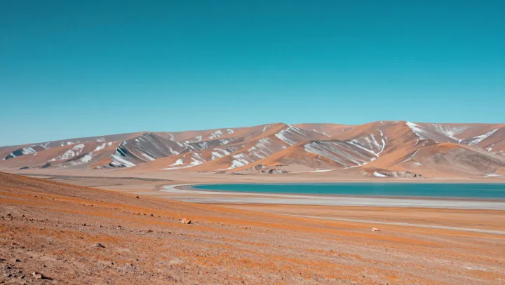
Bone-dry desert plains may sit on top of one of the largest hidden water stores on Earth. New hydrogeological surveys reveal thick aquifers charged not by recent rainfall, but by flows that began when the region’s climate was far wetter and its river network was active at the surface.
Using isotopic dating and three-dimensional geophysical imaging, scientists trace this groundwater back to so-called fossil water, locked in place for long periods within porous rock. The water appears to be sustained by recharge zones in distant mountain ranges, where orographic lift forces moist air upward and snowmelt seeps into fractured bedrock. Instead of modern storms refilling the basin, gravity and hydraulic gradient quietly move this legacy flow through buried paleo-valleys.
The work relies on textbook concepts such as Darcy’s law, which links flow rate to permeability and pressure, and on mass balance calculations that estimate how much water the aquifer can yield without depleting it. Remote-sensing radar, combined with electrical resistivity tomography, maps buried channels that once carried surface rivers and now act as subsurface pipelines. For communities and planners, the finding turns a supposedly waterless landscape into a complex, finite reservoir whose long recharge time demands careful management.