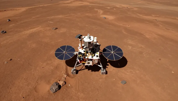
A frozen field of rock and dust on Mars became the backdrop for a peculiar kind of portrait: a stationary rover building its own selfie from more than one hundred filtered frames. Mounted cameras panned and tilted in tiny increments, capturing overlapping slices of deck, instruments, wheels, and the surrounding terrain at multiple wavelengths, from visible light into the near‑infrared. Software on Earth later registered each frame, corrected for perspective distortion, and composited them into a seamless mosaic, with the robotic arm digitally erased like a photographer stepping out of the shot.
The apparent vanity had a harder purpose. Every filter combination acted as a controlled experiment in reflectance spectroscopy, letting scientists derive mineralogy, grain size, and hydration state of the regolith and shallow ice. By comparing calibrated pixel values to lab spectra, teams could infer sulfate content, bound water, and the mechanical properties that govern thermal inertia and erosion. These mosaics also tied surface features to subsurface radar and neutron detector data, tightening constraints on phase transitions in buried ice and the entropy budget of the local climate system. The selfie was less a postcard than a ground‑truth anchor for models of Martian water, weather, and long‑term habitability.
Seen that way, the rover’s stitched face is simply the sharpest map of its own laboratory bench: a geometric reference frame where every bolt, dust layer, and ice‑stained stone helps decode how a cold planet stores and trades its limited water.