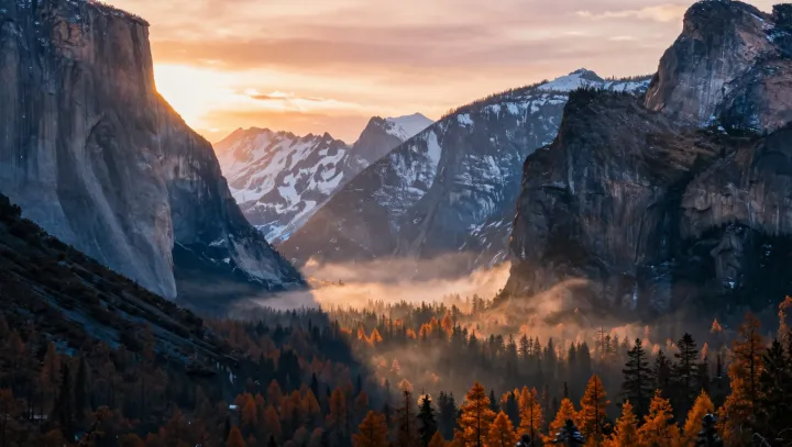
Those soft fog bands are not romantic accidents at all. They are what happens when cold air, trapped as a stable layer, meets a valley floor shaped almost like a channel in a wind tunnel and then gets lit by a low solar disk. At the heart of the forecast is the temperature inversion profile: radiosonde or model output gives vertical gradients of potential temperature and humidity, which set the altitude where air first reaches saturation under nocturnal radiative cooling.
The surprising part is how hard the valley geometry drives the script. Narrow cross‑sections and shallow outlet slopes restrict drainage flow, so continuity equations and simple computational fluid dynamics runs can show where cold air pools to extend fog depth and where ridges break it into separate bands. Combine hypsometric calculations with digital elevation models and you can estimate which contour slices will sit inside the saturated layer and which slopes will protrude above it as clear “islands” at first light.
Yet the cinematic glow is almost pure radiative transfer. Once droplet size distributions are inferred from supersaturation and cloud microphysics schemes, Mie scattering solutions give phase functions that favor forward scattering, and radiance models can map how a given solar zenith angle produces those bright edges and darker cores. Feed inversion strength, valley cross‑section and aerosol optical depth into a coupled boundary‑layer and radiative code, and the so‑called storybook scene reduces to a parameter set and a forecast map.