A small contour on the map holds a scale that feels wrong. Durmitor National Park in Montenegro occupies only a modest patch of the Dinaric Alps, yet within a short drive it stacks a canyon deeper than the Grand Canyon, jagged glacial peaks and high plateaus into one compressed frame.
This compression is no accident of cartography. The park sits on a thick block of uplifted limestone pushed upward by plate tectonics, then riddled by karst processes that dissolve rock and open vertical shafts, so elevation changes accumulate fast instead of spreading gently across a wide area.
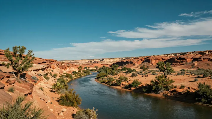
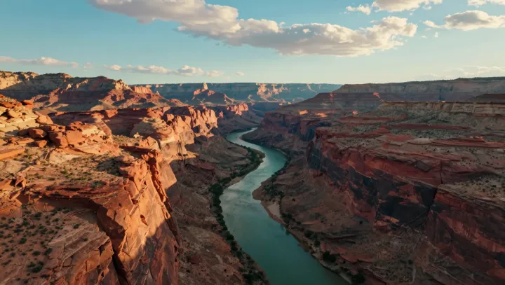
The record depth of the Tara River Canyon is the most counterintuitive piece. A relatively narrow river has incised more than a kilometer into the uplifted massif through fluvial erosion, slicing down faster than side valleys could widen the gorge, so depth wins over breadth and the dramatic drop fits into a slim corridor.
High above that incision, the story flips. Pleistocene glaciers scraped cirques and arêtes into the summit block, then left behind hanging valleys that now form cool alpine plateaus. Because the tectonic uplift raised the whole block as one unit, these benches sit close to the canyon rim instead of fading away over long distances.
What looks like improbable abundance in a tiny park is really tight stacking of geomorphic extremes, all driven by the same collision of plates, dissolving limestone and aggressive ice and river work operating in a very limited radius.