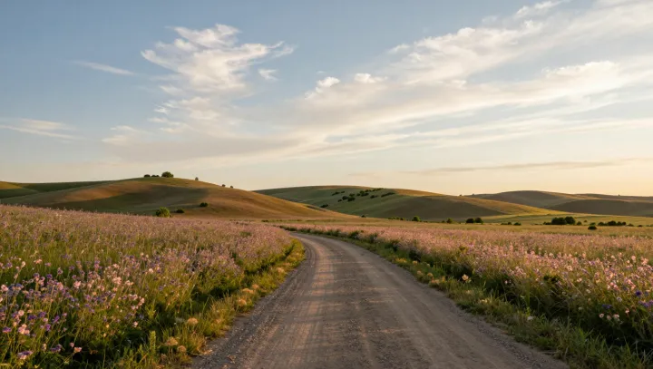
A dirt road often has more authority than any zoning map. Its curve across open hills is not random; it follows slope, soil stability, and drainage, minimizing energy and maintenance cost. Each bend avoids steep gradients, flood prone hollows, and erodible cuts, translating raw topography into a single, legible line of least resistance.
From that line, human geography falls into place. Farmsteads cluster near it because access time, not abstract area, determines usable land. A field beside the track gains lower transaction cost for every sack of grain or crate of produce. Over time, those marginal gains harden into property boundaries, parcel geometry, and a clear hierarchy between roadside land and interior plots that stay underused or wild.
Towns, too, are rarely free agents; they anchor to junctions where such dirt roads intersect. At these nodes, network effects and path dependence dominate: once a store, a school, or a clinic appears, the sunk investment locks the location in. The original curve across the hills remains, quietly steering later upgrades to gravel, asphalt, and utilities, long after the road’s dusty origin is forgotten.