A yawning volcanic basin, not a picturesque island, came first. An explosive eruption emptied a magma chamber, the cone collapsed, and seawater rushed in, creating a steep‑walled caldera. What looks today like a broken ring of land began as the scar of one of the strongest recorded volcanic events in the Aegean basin.
Over long spans, tectonic uplift and continued volcanic activity reshaped that scar, lifting rims, stacking lava domes, and hardening layers of ash and pumice into fragile rock. Erosion then cut sheer cliffs where land met sea, exposing cross‑sections of the eruption like stratified pages in a geological archive. The caldera’s inner walls, unstable yet commanding, offered narrow platforms overlooking deep water.
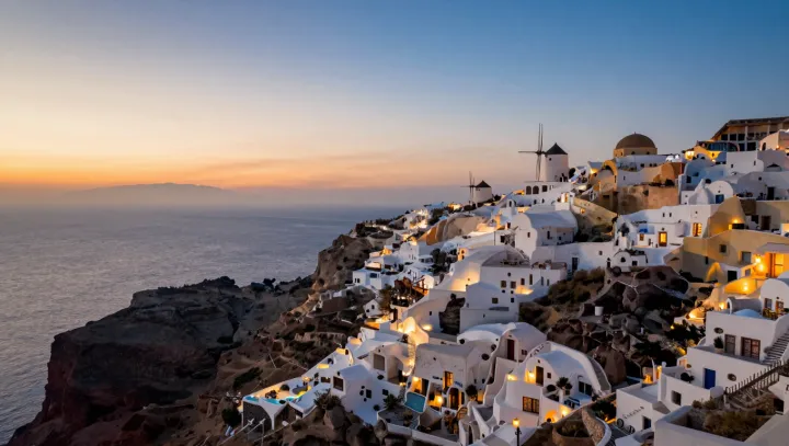
Human settlement arrived late to this sequence. People traced paths along the rim, carving dwellings into softer layers to buffer heat and wind while reducing the material needed for construction. Whitewashed surfaces reflected harsh sunlight and moderated temperature on these compact terraces. Over time, villages expanded along the cliff edge, following the topography of the caldera rather than imposing a grid, turning a collapsed volcanic crater into an inhabited amphitheater above the Aegean.